I am a

student

institution

career professional
Breaking News
- Sunbird AI Student Internship Program ...Read More
- Sunbird AI Fellows Program ...Read More
- Call for Applications for MOTIV Media Academy ...Read More
- Ground Breaker Full time Scholarship for girls to study Software Engineering ...Read More
- AU Digital and Innovation Fellowship - Cohort 2 ...Read More
- Apply to Women Institute of Technology and Innovation for 2024 Intake (Fully Funded) ...Read More
- Higher Education Students Financing Board Call for Student's Loan Application for AY 2023-2024 ...Read More
- Government Allied Health Training Institutions in Uganda ...Read More
- Government Nursing and Midwifery Training Institutions offering Diploma and Certificate Programs ...Read More
- Ministry of Education and Sports Mauritius - Africa Scholarship Scheme 2024 Edition ...Read More


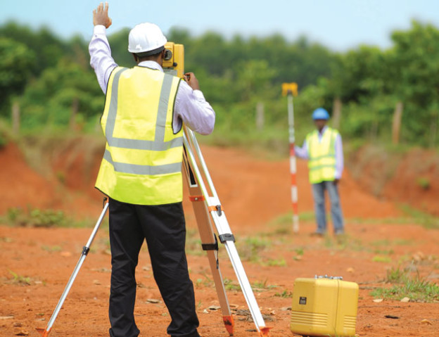
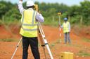
Surveyor
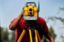
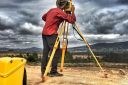
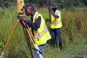
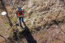
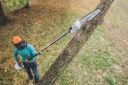
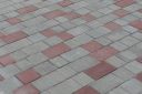
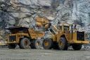
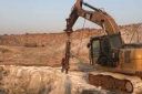
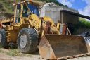
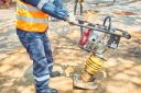
Surveyors make precise measurements to determine property boundaries. They provide data relevant to the shape and contour of the Earth's surface for engineering, map making, and construction projects.They are also called Land Surveyors
Add to FavouritesSurveyors make precise measurements to determine property boundaries. They provide data relevant to the shape and contour of the Earth's surface for engineering, map making, and construction projects.
Daily Activities
Surveyors typically do the following:
1. Measure distances and angles between points on, above, and below the Earth's surface
2. Travel to locations and select known reference points to determine the exact location of important features
3. Establish stake sites and official land and water boundaries
4. Research land records, survey records, and land titles
5. Look for evidence of previous boundaries to determine where boundary lines are located
6. Record the results of surveying and verify the accuracy of data
7. Prepare plots, maps, and reports
8. Present findings to clients, government agencies, and others
9. Take notes of land for deeds, leases, and other legal documents
10.Provide expert testimony in court regarding survey work
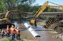
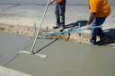
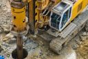
Surveyors provide documentation of legal property lines and help determine the exact locations of real estate and construction projects. For example, when property, such as a house or commercial building, is bought or sold, it may need to be surveyed to prevent boundary disputes. During construction, surveyors determine the precise location of roads or buildings and proper depths for building foundations. The survey also shows changes to the property line and indicates potential restrictions on the property as far as what can be built on it.
In their work, surveyors use Global Positioning System (GPS), a system of satellites that locates reference points with a high degree of precision. Surveyors interpret and verify GPS results.
Surveyors also use Geographic Information System (GIS)—a technology that allows surveyors to present data visually as maps, reports, and charts. For example, a surveyor can overlay aerial or satellite images with GIS data, such as tree density in a given region, and create computerized maps. They then use the results to advise governments and businesses on where to plan homes, roads, and landfills.
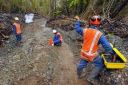
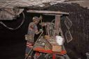
Surveyors take measurements in the field with a crew, a group that typically consists of a licensed surveyor and trained survey technicians. The person in charge of the crew (called the party chief) may be either a surveyor or a senior surveying technician. The party chief leads day-to-day work activities.
Surveyors may be involved in settling boundary disputes. When property is sold or new construction takes place, such as the building of a fence, issues may arise due to lack of up-to-date records or the misinterpretation of available records. A surveyor would be called in to settle the dispute, and may even have to provide testimony in court if the involved parties do not come to an agreement.
Surveyors also work with civil engineers, landscape architects, and urban and regional planners to develop comprehensive design documents.
Some surveyors work in specialty fields to survey particular characteristics of the Earth.
Types of Surveyors
Geodetic surveyors use high-accuracy technology, including aerial and satellite observations, to measure large areas of the Earth's surface.
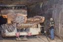
Geophysical prospecting surveyors mark sites for subsurface exploration, usually to look for petroleum or natural gas fields.
Marine or hydrographic surveyors survey harbors, rivers, and other bodies of water to determine shorelines, the topography of the bottom, water depth, and other features.
Important Qualities
Communication skills. Surveyors must provide clear instructions to team members. They must also be able to receive instructions from architects and construction managers, and explain the job's progress to developers, lawyers, financiers, and government authorities.
Detail oriented. Surveyors must work with precision and accuracy due to the legal nature of the documents they produce.
Physical stamina . Surveyors traditionally work outdoors, often in rugged terrain. Therefore, they must be able to walk long distances for several hours.
Problem-solving skills. Surveyors must figure out discrepancies between documents showing property lines and current conditions on the land. If there were changes in previous years, they must figure out the reason for the changes so that property lines can be reestablished.
Technical skills. Surveyors use sophisticated technologies such as distance- and slope-measuring "total stations" and GPS devices to collect land survey data.
Time-management skills. Surveyors must be able to plan their time and their team members' time on the job. This is critical when pressing deadlines exist or while working outside during winter months when daylight hours are short.
Visualization skills. Surveyors must be able to envision new buildings and distances.


Draw Inspiration from time tested individuals

Careers that are in the same career field as Surveyor
-
 Know more
 -
 Know more
 -
 Know more
 -
 Know more
 -
 Know more
 -
 Know more
 -
 Know more
 -
 Know more
 -
 Know more
 -
 Know more
 -
 Know more
 -
 Know more
 -
 Know more
 -
 Know more
 -
 Know more
 -
 Know more
 -
 Know more
 -
 Know more
 -
 Know more
 -
 Know more
 -
 Know more
 -
 Know more
 -
 Know more
 -
 Know more
 -
 Know more
 -
 Know more
 -
 Know more
 -
 Know more
 -
 Know more
 -
 Know more
 -
 Know more
 -
 Know more
 -
 Know more
 -
 Know more
 -
 Know more
 -
 Know more
 -
 Know more
 -
 Know more
 -
 Know more
 -
 Know more
 -
 Know more
 -
 Know more
 -
 Know more
 -
 Know more
 -
 Know more
 -
 Know more
 -
 Know more
 -
 Know more
 -
 Know more
 -
 Know more
 -
 Know more
 -
 Know more
 -
 Know more
 -
 Know more
 -
 Know more
 -
 Know more
 -
 Know more
 -
 Know more
 -
 Know more
 -
 Know more
 -
 Know more
 -
 Know more
 -
 Know more
 -
 Know more
 -
 Know more
 -
 Know more
 -
 Know more
 -
 Know more
 -
 Know more
 -
 Know more
 -
 Know more
 -
 Know more
 -
 Know more
 -
 Know more
 -
 Know more
 -
 Know more
 -
 Know more
 -
 Know more
 -
 Know more
 -
 Know more
 -
 Know more
 -
 Know more
 -
 Know more
 -
 Know more
 -
 Know more
 -
 Know more
 -
 Know more
 -
 Know more
 -
 Know more
 -
 Know more
 -
 Know more
 -
 Know more
 -
 Know more
 -
 Know more
 -
 Know more
 -
 Know more
 -
 Know more
 -
 Know more
 -
 Know more
 -
 Know more
 -
 Know more
 -
 Know more
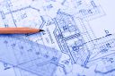
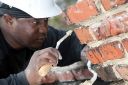
Online Training in Architecture and Construction